
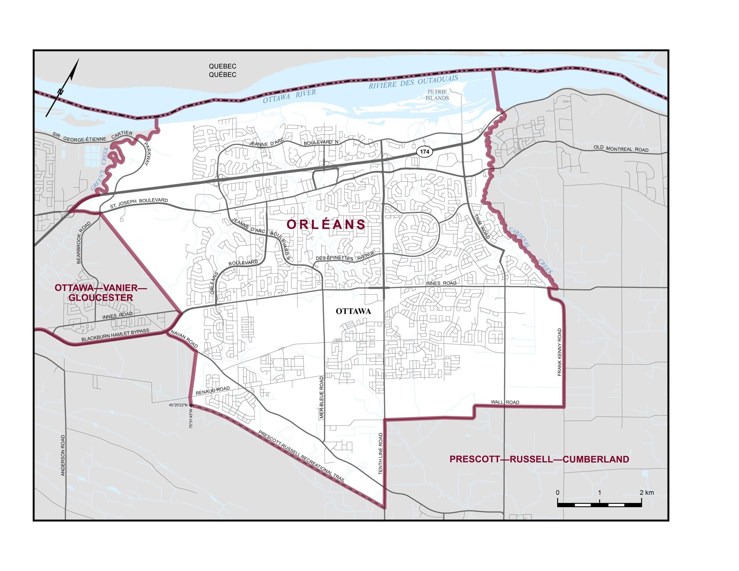
Did you know the boundaries for Orléans has changed for the 2025 general election? Take a look at the map above and description below to make sure you know if you are a resident of the Orléans riding.
Boundaries Description
Consists of that part of the City of Ottawa described as follows: commencing at the intersection of Regional Road 174 and Cardinal Creek; thence generally southeasterly along said creek to Innes Road; thence westerly along said road to Frank Kenny Road; thence generally southeasterly along said road to Wall Road; thence generally southwesterly along said road to Tenth Line Road; thence southeasterly along said road to the Prescott-Russell Recreational Trail; thence westerly along said trail to a point at approximate latitude 45°25’22″N and longitude 75°31’43″W; thence northwesterly in a straight line to Renaud Road at approximate latitude 45°25’28″N and longitude 75°31’47″W; thence northerly in a straight line to Navan Road at approximate latitude 45°26’02″N and longitude 75°31’59″W; thence westerly along said road to Blackburn Hamlet Bypass; thence northerly along said bypass to Innes Road; thence northwesterly in a straight line to the intersection of Sir George-Étienne Cartier Parkway and St. Joseph Boulevard; thence southwesterly along said boulevard to Regional Road 174; thence northeasterly along said road to Green’s Creek; thence generally northerly along said creek and its production to the interprovincial boundary between Ontario and Quebec at approximate latitude 45°28’36″N and longitude 75°34’13″W; thence northeasterly along said boundary to a point at approximate latitude 45°30’44″N and longitude 75°28’54″W; thence southeasterly in a straight line to the mouth of Cardinal Creek; thence generally southeasterly along said creek to the point of commencement.